The Boundary of the Eastern Ghats
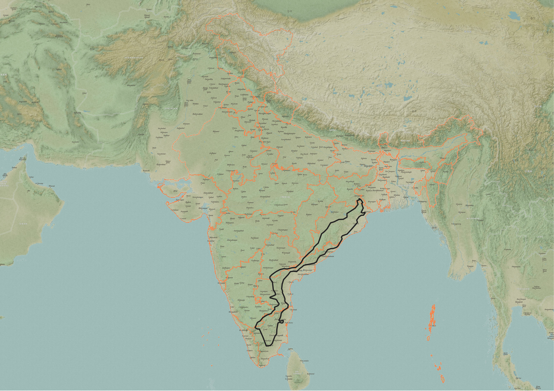
The Eastern Ghats are a set of hill ranges along the East Coast of India, running predominantly across five states from Tamil Nadu in the south to Odisha in the north. Older than the Western Ghats and the Himalayas, they have a complex geological history. They are not formed from one geological formation or event, but the different hill ranges and rocks across the length of the Eastern Ghats vary in age and structure. The oldest rocks in this region date back to the Archaen period (over 2.5 billion years ago), indicating that these formations existed before Indian subcontinent was formed.
Most of the Eastern Ghats lie in Andhra (~40%), followed by Tamil Nadu and Odisha (~25% each). The Eastern Ghats are broadly classified into three sections - Northern, Central and Southern. The northernmost part of the Northern section is widely believed to start at the Khondmal hills in the Phulbani district (Baudh-Khandmai), Odisha, including the Simlipal Massif, and extends south to the Guntur region in Andhra Pradesh. The Central section runs through Andhra Pradesh, from the Krishna river to present-day Chennai, with over 30 hill ranges, including the Lankamala, Nallamalai, Palkonda, Velikonda and Seshachalam Hills, among others. A small region lies in the Amrabad region of Telangana. The Southern section comprises disparate hill ranges in Tamil Nadu, inlcuding the Javadi, Gingee, Shevroy, Kalrayans, Kollimalai hills, and the Biligirirangan Hills in Karnataka. This list was compiled largely from Legris and Meher-Homji (1977) and GrACE (2019); references are below.
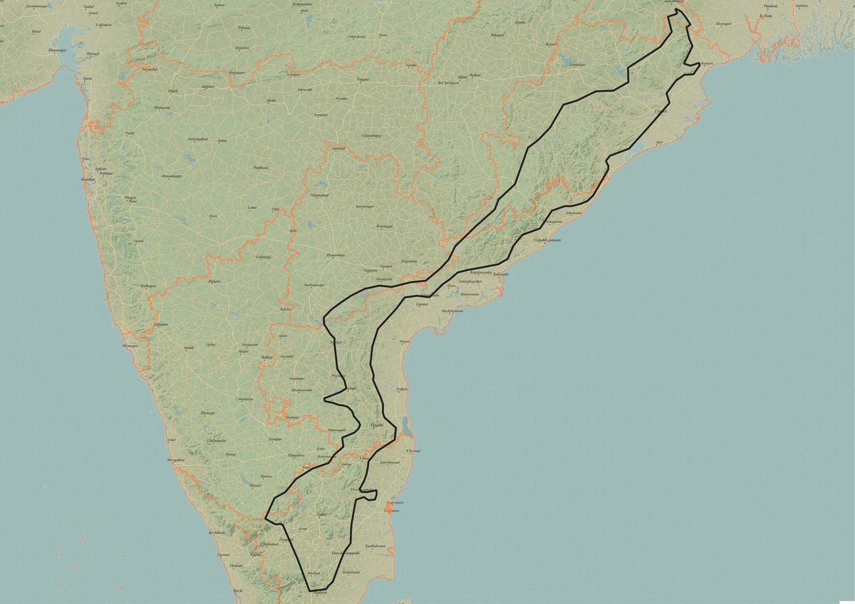
In their entirety, the Eastern Ghats are made up of over 50 hill ranges, and it is challenging to delineate the region as one composite area. Ahead of the Eastern Ghats Symposium 2025, we developed a broad KML boundary of the Eastern Ghats in order to provide a standardised spatial reference for researchers. This boundary, pictured below, is available for download - referenced below.
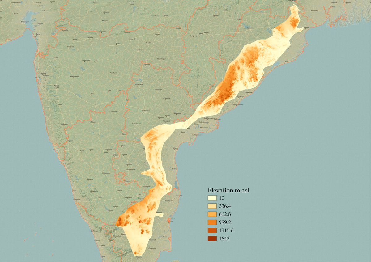
The Eastern Ghats are mostly medium elevation hills, with Deomali in Koraput, Odisha, being the highest peak at 1670m asl. Most of the Eastern Ghats are low, with an average elevation of 400-600m asl.
The boundary was delineated by tracing and mapping across the major hill ranges and physiographic units described and published in the literature. The key physiographic units included hills and ranges of Odisha, Andhra Pradesh, Telangana, Karnataka, and Tamil Nadu, and a boundary was traced to capture the geographic extent of the Eastern Ghats as a single continuous polygon. This was further cross-referenced with Google Earth satellite, terrain and SRTM Digital Elevation Model layers using a combination of Google My Maps and QGIS.
We hope that this boundary layer will serve as a practical spatial tool for researchers by enabling consistent overlay with species distribution records, land-use land cover data, remotely sensed data and other such ecologically relevant datasets. Standardising the geographic frame of reference facilitates systematic analysis and enhances comparability across studies. It also supports conservation management and planning in the Eastern Ghats.
Further Reading #
- Legris, P and VM Mehr-Homji. 1977. Phytogeographic outlines of the hill ranges of peninsular India. Tropical Ecology 18(1):10-24
- GrACE. 2019. Eastern Ghats Environment Outlook, Greens’ Alliance for Conservation of Eastern Ghats, Hyderabad, India.
- Udayraj, S., & Rajamani, N. (2025). Boundary layer of the Eastern Ghats mountains, India. Zenodo. https://doi.org/10.5281/zenodo.17307944